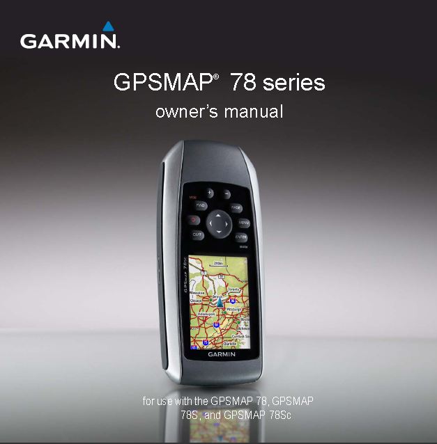
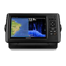
GPS-Marine HH, 2.6″, Colour, Map 78-s, Altimeter, Compass
categories:
Outdoor, Global Positioning System, Engineering Products, Selling Products
Availablity: in stock
SKU: 0100.0864.05
- မြန်မာစာတန်းထိုးဖြင့် အသုံးပြုနိုင်ခြင်း၊
- ဂြိုလ်တုဖမ်းနှုန်းမြင့်မားခြင်း၊
- ရေကြောင်း နှင့် ကုန်းကြောင်း နှစ်မျိုးအသုံးပြုနိုင်ခြင်း၊
- ၃ လက်မ၊ ကာလာမျက်နှာပြင်ဖြင့် အသုံးပြုနိုင်ခြင်း၊
- လိုအပ်သည့်မြေပုံ၊ ရေပုံ များထည့်သွင်းအသုံးပြုနိုင်ခြင်း၊
- Point (2000), Tracks (200), Routes (50) အထိ မှတ်သားနိုင်ခြင်း။
rugged GPSMAP 78s features a 3-axis compass, barometric altimeter, crisp color mapping, high-sensitivity receiver, new molded rubber side grips, plus a microSD™ card slot for loading additional maps. And it floats!
This price is inclusive of Commercial Tax 5%.
Description
- High-sensitivity, WAAS-enabled GPS receiver and HotFix
- Floats
- Rugged, waterproof (IEC 60529 IPX7)
- Worldwide built-in basemap with shaded relief
- 1.7 GB of internal memory, plus microSD card slot for optional mapping
and data storage - Wirelessly share thumbnails, routes, tracks, waypoints and geocaches
between compatible units - Bright 2.6″ LCD sunlight readable color display (160 x 240 pixels)
- 3-axis compass, provides accurate heading even when the unit is not held level (78s, 78sc)
- Barometric altimeter tracks pressure changes to pinpoint your precise altitude and to help monitor weather (78s,78sc)
- High-speed USB interface (78s, 78sc) and NMEA 0183 (GPSMAP 78 series)
- Up to 20 hours of battery life; battery type: 2AA (not included) NiMH or lithium recommended
- Weight: 7.7 oz. with batteries
Physical & Performance
| Physical dimensions | 2.6″ x 6.0″ x 1.2″ (6.6 x 15.2 x 3.0 cm) |
| Display size, WxH | 1.43″ x 2.15″ (3.6 x 5.5 cm); 2.6″ diag (6.6 cm) |
| Display resolution, WxH | 160 x 240 pixels |
| Display type | transflective, 65-K color TFT |
| Weight | 7.7 oz (218.3 g) with batteries |
| Battery | 2 AA batteries (not included); NiMH or Lithium recommended |
| Battery life | 20 hours |
| Water rating | IPX7 |
| Memory/ History | 1.7 GB |
| High-sensitivity receiver | Yes |
| Interface | high-speed USB and NMEA 0183 compatible |
| Maps & Memory | Yes |
| Ability to add maps | Yes |
| Basemap | Yes |
| Storage and Power Capacity | microSD™ card (not included) |
| Track log | 2000 |
| Sensors | 200 |
| Barometric altimeter | 10,000 points, 200 saved tracks |
| Compass | Yes (tilt-compensated 3-axis) |
| Outdoor Recreation Features | Yes |
| Area calculation | Yes |
| Automatic routing (turn by turn routing on roads) | Yes (with optional mapping for detailed roads) |
| Geocaching-friendly | Yes (Paperless) |
| Custom maps compatible | Yes |
| Hunt/fish calendar | Yes |
| Sun and moon information | Yes |
| Picture viewer | Yes |
| Garmin Connect | Yes |
| Garmin Connect™ compatible (online community where you analyze, categorize and share data) | Yes |
For detailed specifications refer to the Product Brochure.
GARMIN GPS
GPSMAP 78S
The device records a track log while you are moving. You can save these tracks and navigate to them later. You can view archieved or loaded tracks by selecting Track Manager from the main menu.
1 review for GPS-Marine HH, 2.6″, Colour, Map 78-s, Altimeter, Compass
You must be logged in to post a review.


 Shop
Shop
Dr Than Win –
Very easy to use.
Myanmar fonts.
Very rugged.