Aquamap 80xs ,Global Positioning System ,GPS
မြန်မာဘာသာဖြင့် အသုံးပြုနိုင်ခြင်း၊ (၈)လက်မ Colour မျက်နှာပြင်ဖြင့် အသုံးပြုနိုင်ခြင်း၊ ရေအောက်ကြည့် ှSonar, Way Point (12,000), Track (200), Route (200) Data Card 2 Card အပြင် Sounder နှင့် Rader ကို တွဲဘက် အသုံးပြုနိုင်ခြင်း၊ Sonar Record လုပ်နိုင်ခြင်း။
Description
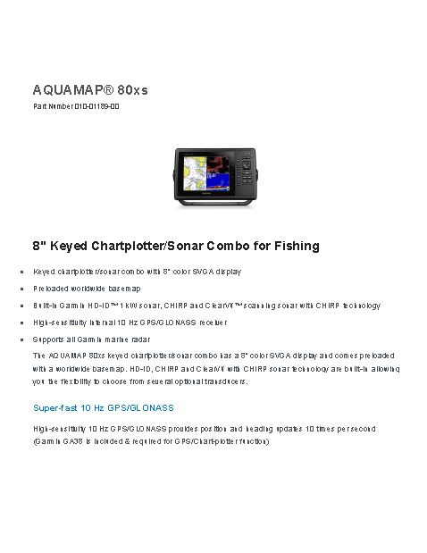
- Keyed chartplotter/sonar combo with 8” color SVGA display
- Preloaded worldwide basemap
- Built-in Garmin HD-ID™ 1 kW sonar, CHIRP and ClearVü™ scanning sonar with CHIRP technology
- High-sensitivity internal 10 Hz GPS/GLONASS receiver
- Supports all Garmin marine radar
Physical & Performance
| Physical dimensions | 11.5″ x 7.4″ x 2.9″ (29.3 x 18.8 x 7.4 cm) |
| Display size, WxH | 6.4″ x 4.8″; 8.0″ diagonal (16.2 x 12.1 cm; 20.3 cm diagonal) |
| Display resolution, WxH | 800 x 600 pixels |
| Display type | SVGA display |
| Weight | 3.5 lbs (1.6 kg) |
| Waterproof | (IPX7) |
| Receiver | 10 Hz high-sensitivity |
| Antenna | with external connection |
| Mounting options | Bail, flat or flush |
|
Power consumption |
Max power usage at 10 Vdc: 14 W
Typical current draw at 12 Vdc: 1.1 A Max current draw at 12 Vdc: 3.2 A |
| Accepts data cards | 2 SD™ cards |
| Waypoints | 12,000 |
| Routes | 200 |
| Track log | 25,000 points; 100 saved tracks |
For detailed specifications refer to the Product Brochure.
GARMIN GPS
Aquamap 80xs
AQUAMAP 80xs displays crystal-clear sonar images detailing fishing hot spots, ship wreckage or a diving location. With Garmin CHIRP technology, you get remarkabel target separation and resolution at extraordinary depths, and can dial into specific frequencies to target certain species of sport fish.
You must be logged in to post a review.


 Shop
Shop
Reviews
There are no reviews yet.