Magnet Software
- MAGNET software productivity suite streamlines your project process.
- Topcon evolved what modern software solutions can do to allow your team to work seamlessly.
- From Autodesk data integration capabilities, to real-time data exchange between office and field, and so much more. Explore what’s possible with MAGNET.
မည်သည့် Total Station နှင့်မဆို Download ပြုလုပ်နိုင်သော Surveying Software Contour maps, Cutting & Filling volume များကို စကေးအမျိုးမျိုးဖြင့် လျှင်မြန်စွာရေးဆွဲနိုင်ခြင်း၊ ပုံထုတ်နိုင်ခြင်း။
ရိုးရှင်းလွယ်ကူစွာ အသုံးပြုနိုင်ခြင်း၊ ပြည့်စုံကောင်းမွန်သော Software Application သင်ကြားမှု (လစဥ်)။
Description
Topographic Survey
Collect points, lines, areas, cross sections, surfaces, and auto topo points. Select Map or Measurement View and even record offset shots all while within Topo Survey.
Stake Points
Whatever method of layout or stakeout you need, we have the solution for you. Point, Lines, Offsets, Roads, Surface, Slope, and Real-Time Roads are all available.
Real-Time Roads
See all the road stakeout information on one screen as you stake anywhere along the road design in real-time. Be more productive with Real-Time Roads information.
Data Exchange
Exchange data locally via USB stick, USB cable, or more commonly connect directly to your private and secure MAGNET Enterprise company account. Import and export with over 100+ industry file formats.
DTM Calculations
Collect volume topography and generate contours, surfaces, and calculate volumes while in the field.
Specifications for the Topcon Magnet Field Software
| Data Collectors | Topcon FC-25, FC-250, FC-236, FC-2600, Tesla, Sokkia SHC25, SHC250, SHC2500, SHC236, Juniper Mesa |
| File Formats | DWG, DXF, RAW, ASCII, TXT |
| Total Stations | PS-101A, PS-103A |
| Operating System | Windows CE.NET 6, Windows Mobile 6 or higher |
| Graphics | VGA 480 x 640 pixels or higher |
| RAM | Minimum of 128MB |
| Disk Space | Minimum of 128 MB |
For detailed specifications refer to the Product Brochure.

Topcon
Magnet Software
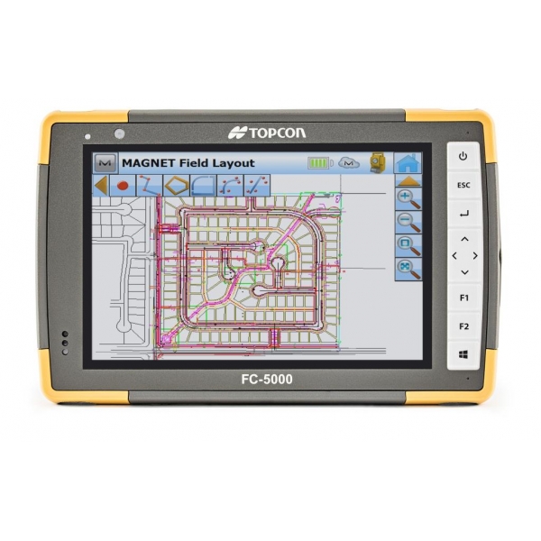
MAGNET Field software is your user interface to our positioning tools. Collect land positioning data and perform construction, road layout, and land surveying, as well as GIS mapping while staying connected with your team. Using local Wi-Fi or integrated cellular connectivity, all mapping and positioning tasks can be performed on a vivid satellite image background giving you full visual context, and allowing you to get the full picture of your project at all times!


 Shop
Shop