Global Positioning System
-
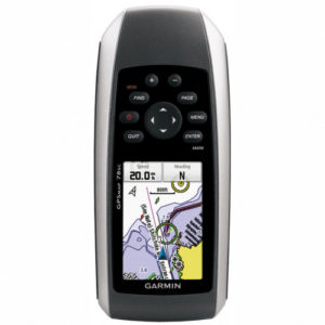
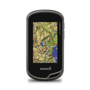
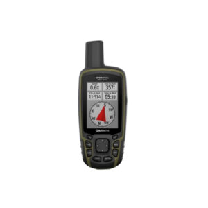
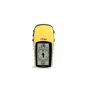
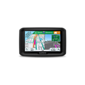
GPS-Marine HH, 2.6″, Colour, Map 78-s, Altimeter, Compass
မြန်မာစာတန်းထိုးဖြင့် အသုံးပြုနိုင်ခြင်း၊ ဂြိုလ်တုဖမ်းနှုန်းမြင့်မားခြင်း၊ ရေကြောင်း နှင့် ကုန်းကြောင်း နှစ်မျိုးအသုံးပြုနိုင်ခြင်း၊ ၃ လက်မ၊ ကာလာမျက်နှာပြင်ဖြင့် အသုံးပြုနိုင်ခြင်း၊ လိုအပ်သည့်မြေပုံ၊ ရေပုံ များထည့်သွင်းအသုံးပြုနိုင်ခြင်း၊ Point (2000), Tracks (200), Routes (50) အထိ မှတ်သားနိုင်ခြင်း။ rugged GPSMAP 78s features a 3-axis compass, barometric altimeter, crisp color mapping, high-sensitivity receiver, new molded rubber side… -
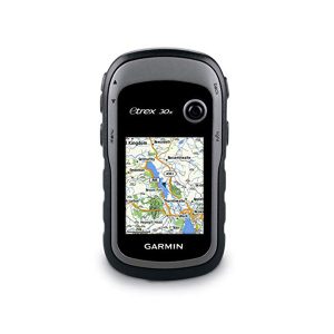
GPS-Outdoor HH, 2.2 colour, eTrex-30-x, altimeter, compass- for out door
Greater resolution with 240 x 320 display pixels for improved readability Internal memory expanded to hold more maps Worldwide basemap with shaded relief 2.2-inch, 65K color, sunlight-readable display 3-axis compass and barometric altimeter eTrex 30x is our upgraded version of… -
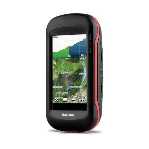
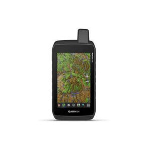
Montana 680 , GPS
Touch Screen ဖြင့် အသုံးပြုနိုင်ခြင်း၊ 4'' လက်မ ကာလာမျက်နှာပြင်၊ 8 Megapixel Camera ပါဝင်ပြီး ဓာတ်ပုံများအား ကြည်လင်ပြတ်သားစွာ ရိုက်ကူးနိုင်ခြင်း၊ Micro SD Card ထည့်သွင်းနိုင်ခြင်း၊ Memory 4GB ပါဝင်ခြင်း၊ Way Point 10000, Tracks 250, Routes 250, အထိမှတ်သားနိုင်ခြင်း၊ Barometic Altimeter ဖြင့် အမြင့်ပေ တိုင်းတာနိုင်ခြင်း၊ Battery Type နှစ်မျိုးဖြင့် အသုံးပြုနိုင်ခြင်း။ Rugged GPS/GLONASS… -
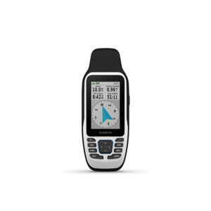
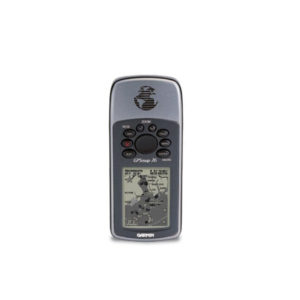
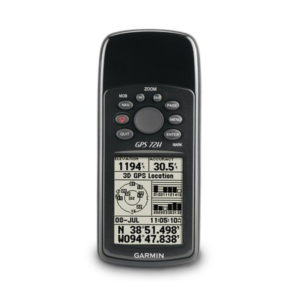
GPS 92
At the heart of the unit is a Jeppesen—database with approach, departure, and FSS and ARTCC frequencies. Airport, VOR, NDB, Intersection, and SUA information has never been handier, not to mention airport-specific runway and comm frequencies. What's more, the GPS… -
GPS-Outdoor HH, 3, Colour, Oregon 650-WW, camera, altimeter, compass
3-inch sunlight-readable touchscreen display with dual orientation 8 megapixel autofocus camera with LED flash/torch Worldwide basemap with shaded relief 3-axis compass with accelerometer and barometric altimeter sensors Dual battery system — 2 AA batteries or included rechargeable internal NiMH pack… -
GPS-Fish-Finder,3.5,CHIRP,FF-250, w/4-pin DB Transducer
Multi language support: FF250 GPS is available in the following 8 languages so you can use more effectively, including English, Simplified Chinese, Thai, Vietnamese, Malaysia Bahasa, Hindi, Gujarat and Tagalog. One new Over Voltage Protection design that with an… -
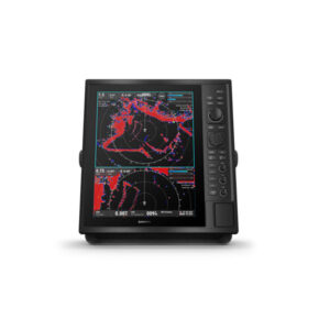
Garmin GPSMAP 79S
လိုင်းစွဲအား ကောင်းမွန်တဲ့ high-sensitivity GPS receiver တပ်ဆင်ထားခြင်း အရပ်မျက်နှာ၊ ဒီဂရီများ ကြည့်ရှုနိုင်တဲ့ 3-axis compassနှင့် လေထုဖိအား၊ အမြင့်ပေတိုင်းတဲ့ Barometric Altimeter တို့ ပါဝင်ခြင်း ၂.၆ လက်မ ကာလာမျက်နှာပြင် ဖြစ်ပြီး နေရောင်အောက်တွင်လည်း ကောင်းမွန်စွာ ကြည့်ရှုအသုံးပြုနိုင်ခြင်း ရေစိုခံနိုင်မှု water rating IPX 7 ဖြစ်တဲ့အတွက် အကြမ်းခံခြင်း world wide based map (ကမ္ဘာ့မြေပုံကြမ်း) Built In ပါဝင်ခြင်း ကြိုးမဲ့ချိတ်ဆက်မှု… -
GPS-Combo, 4.3, echoMAP-Plus-45cv, CHIRP, APAC, w/o XDCR
Bright, sunlight-readable 4.3” combo Built-in support for Garmin CHIRP traditional sonar plus CHIRP ClearVü scanning sonar (transducer sold separately) Preloaded worldwide basemap; compatible with BlueChart g2 HD and BlueChart® g2 Vision HD Built-in Quickdraw Contours mapping software instantly creates personalized… -
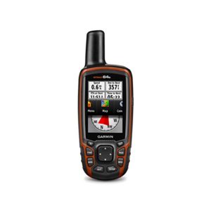
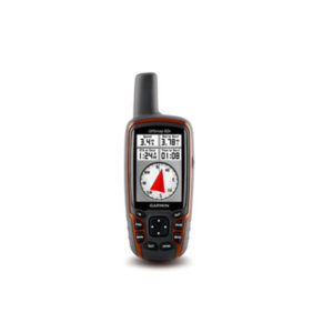
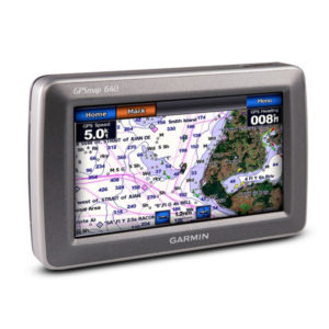
GPSMAP 64S , GPS , Marine GPS
3'' Colour မျက်နှာပြင်ဖြင့် အသုံးပြုနိုင်ခြင်း၊ Way Point 5000, Track 200, Route 200 ဂြိုလ်တုဖမ်းနှုန်းမြင့်မားခြင်း၊ Altimeter ဖြင့် အမြင့်ပေ တိုင်းတာနိုင်ခြင်း၊ SD Card ထည့်သွင်းအသုံးပြုနိုင်ခြင်း၊ ချောက်ကမ်းပါးနှင့် မြစ်ချောင်းများ၏ တစ်ဖက်တွင်ရှိသော အမှတ်များကိုမှတ်သားနိုင်ခြင်း၊ အသုံးပြုသူ၏ လိုအပ်သော မြေပုံများ ထည့်သွင်းအသုံးပြုနိုင်ခြင်း။ Rugged, Full-featured Handheld with GPS, GLONASS and Wireless Connectivity This price is inclusive… -
GPS-Outdoor HH, 4.5″, Colour, Touch-Screen, Oregon-750, Camera, Multi Touch
3" Touch Screen LiveTracking Live Geocaching 3D Electronic Compass 8MP Digital Camera Rugged GPS/GLONASS Handheld with Built-in Wi-Fi, Camera and More More Connectivity, Less Complexity Find Fun with Geocaching.com Take Geotagged Pictures Navigate Your Way Enjoy the View on a… -
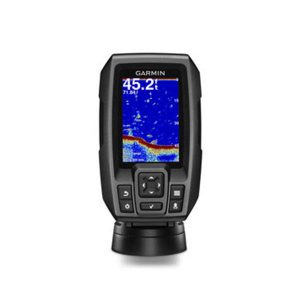
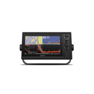
Striker Plus 4cv ,Global Positioning System ,GPS
၄ လက်မ ကာလာမျက်နှာပြင်ဖြင့် အသုံးပြုနိုင်သော ရေအောက်ငါးကြည့်စက် လှိုင်းလွှင့်အား W500 ကို အသုံးပြုထားသဖြင့် ရေအောက်သို့ မြင်ကွင်း(၂)မျိုးဖြင့် ကြည်လင်တိကျစွာ ကြည့်ရှုနိုင်ခြင်း၊ ရိုးရိုးကြည့်မြင်ကွင်းတွင် လှိုင်းလွှင့်အား (၂)မျိုးဖြစ်သော CHIRP 77 KHZ နှင့် 200KHZ တို့နှစ်မျိုးကို အသုံးပြုထားခြင်း၊ GPS စနစ်ပါဝင်သောကြောင့် မြေပုံအကြမ်းစာမျက်နှာ၌ ပွိုင့်များမှတ်သားနိုင်ခြင်း၊ ငါးပုံသင်္ကေတဖြင့် ကြည့်ရှုနိုင်ခြင်း၊ ရေအနက် ပေ ၁၆၀၀ အထိ ကြည့်ရှုနိုင်ခြင်း။ -
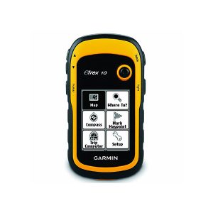
GPS-Outdoor HH, eTrex-10, 2.2″
2.2" မျက်နှာပြင်ဖြင့် အသုံးပြုနိုင်ခြင်း၊ GPS နှင့် GLONASS Satellites နှစ်မျိုးအား ဖမ်းယူနိုင်သဖြင့် လိုင်းဆွဲအား ကောင်းမွန်ခြင်း၊ Waypoint 1000, Track 100, Routes 50 ဈေးနှုန်းအထူးချိုသာခြင်း၊ သယ်ဆောင်ရလွယ်ကူခြင်း။ Rugged Handheld GPS with Enhanced Capabilities This price is inclusive of 5% Tax. -
GPS-Marine, Radar Display CR1522, 15
Under the sun, yet the large, glass-bonded screen is still readable. Being on the radar means offering both traditional and solid-state. A good track record starts with simplify Target Tracking (TT). Follow up to 50 targets. Go long (or short)… -
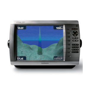
GARMIN Sounder AQUAMAP 1052xs
AQUAMAP 1052xs MFD Power/data cable NMEA 2000 T-connector NMEA 2000 drop cable (2 m) Bail mount kit with knobs Flush mount kit with gasket Protective cover Trim piece snap covers Documentation Inquiry Now! -
GARMIN eTrex 22x
eTrex 22x, USB cable, documentation Made in Taiwan. Cable made in Taiwan or China. 2.2” sunlight-readable color displa Preloaded with TopoActive maps with routable roads and trails for cycling and hiking Support for GPS and GLONASS satellites allows for tracking… -
GARMIN GPS MAP 66sr
Premium GPS Handheld with BirdsEye Satellite Imagery Subscription Get Your Bearings See Where You’re Headed Stay Tuned to Conditions Find Your Cache Find Your Cache Utility in Adverse Environments Inquiry Now! -
GARMIN _ GPSMAP 65s
High-sensitivity dual GPS and GLONASS satellite reception for better performance in challenging environments than GPS alone. 3-inch sunlight-readable touchscreen with dual orientation (landscape or portrait view) Expanded wireless connectivity (Wi-Fi, Bluetooth®, ANT+® capable) Capture locations and memories with the 8… -
Montana 700 Handheld Hiking GPS
Montana 700 Lithium-ion battery pack USB cable Documentation Inquiry Now! -
GPS-Outdoor HH, 2.6, 76-Map
The GPSMAP 76 adds an Americas, European or Pacific basemap and 8 megabytes (MB) of map storage space to the other outstanding features of the mariner-friendly 76-series navigators. The GPSMAP 76 floats in water, and it's IPX7 water resistant to… -
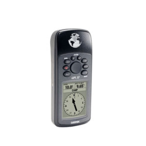
GPS-Outdoor HH, 2.2, GPS-72 Navigator
The mariner-friendly GPS 72 is WAAS-enabled for accuracy to within 9.84 ft (3 m) and features a large screen and easy-to-use buttons. The GPS 72 floats in water, and its IPX7 water resistant to withstand the accidental dunk or splash… -
GPS-Outdoor HH, 2.1, e-Trex-H
Perfect for outdoor enthusiasts on a budget, eTrex H comes with a high-sensitivity GPS receiver that locks onto satellite signals quickly and maintains accuracy — even in the toughest conditions. And just like the popular eTrex, this little yellow wonder… -
GPSMAP 62s
Handheld GPS with Wireless Connectivity 2.6" sunlight-readable color screen Built-in worldwide basemap with shaded relief High sensitivity quad helix GPS antenna for unparalleled reception 1.7 GB of internal memory 3-axis compass with barometric altimeter This price is inclusive of 5%… -
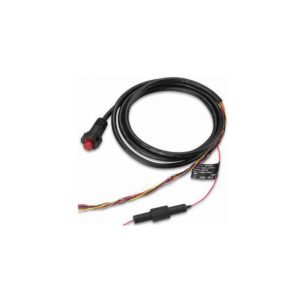
Cable, Power/Data Cable – 4-Pin (Garmin 010-12199-04)
Garmin 010-12199-04 Power/Data Cable - 4-Pin It features numerous features including cable, Cables and Power Cable. -
Transducer, Heavy-duty Plastic, AccssXdcr50/200, for Garmin Sounders
Product description GARMIN Accessories Xdcr 50/200 This plastic transom mount can be used to replace the dual frequency transducers included with many Garmin units. 500 W 6-pin transducer maximum depth of 1,500 ft; operating frequency of 50 to 200 kHz;… -
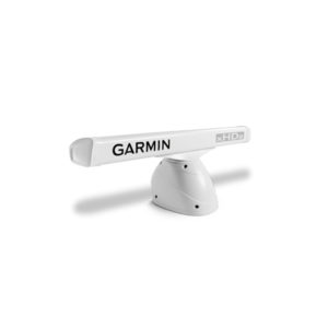
Radar, Open-Array Pedastal, 4kw, GMR-424 xHD2/426xHD2, w/o Antenna, 010-01333-00
4-foot Open Array Radar with 4 kW of Power 4 kW high-definition radar with 4-foot open array High sensitivity with 1.8 degree horizontal beamwidth for consistent target positions, excellent target separation and reliable operation Dual range radar with dual radar… -
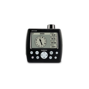
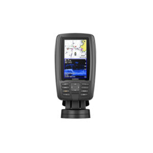
GPS-Marine, 4, 152-H
Get quality trackplotting with the high-sensitivity GPS 152H, a grayscale trackplotter with easy-to-use features that fits both your boat and your budget. Acquire Satellites Quickly The GPS 152H features a high-sensitivity GPS receiver, an internal GPS antenna and a built-in… -
GPS-Marine HH, 2.2, 72-H SEA
Garmin 72H Waterproof Handheld GPS with High-Sensitivity Marine-friendly handheld floats in water and is IPX7 waterproof 120 x 160 pixel grayscale display and 18 hour battery life High-sensitivity GPS receiver acquires satellite signals quickly Tracks your location in challenging conditions,… -
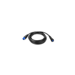
Cable, Transducer Extension Cable, 30ft (8pin) ,Marine GPS Accessory
Garmin Transducer Extension Cable - 8-pin Marine GPS Accessory 010-11617-52 30ft -
Cable, Power/Data For AQUAMAP GPS
GA-0101215200 Garmin Power cable, GPSMAP 800/1000 Series GA-0101215200 Power cable, MFG# 010-12152-00, for GPSMAP 800 and 1000 Series. -
Cable, Power/Data for GPSMap 585
Garmin 010-10918-00 Cable, Power/data (0101091800) Fishfinder 300C Fishfinder 400C GPSMAP® 400 Series GPSMAP® 500 Series -
Cable, Data/Power for GPSMap 2108 ,Marine GPS
Garmin 010-10917-00 Power Data Cable For 400 500 Series (0101091700) Compatibility: Garmin GPSMAP Chartplotter 400/500 Series: 420 420s 421 421s 430 430s 431 431s 440 440s 441 441s 520 520s 521 521s 525 525s 526 526s 530 530s 531 531s… -
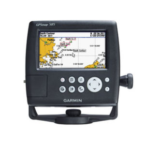
GPSMap 585 ,Ch Plotter, 5″, Colour, Marine GPS
The GPSMAP 585 is a full-function chart plotter that features an ultra-bright 5” WQVGA color display along with an improved feature of high-speed map drawing and panning. It’s ready to go with an easy-to-use interface and a built-in worldwide basemap.… -
GPS-Combo, 5 MAP-580 w/o Sonar
The GPSMAP 580 is a full-function chart plotter that features an ultra-bright 5” WQVGA color display along with an improved feature of high-speed map drawing and panning. It’s ready to go with an easy-to-use interface and a built-in worldwide basemap.… -
GPS-Combo, 10.4, 640-Map-C
This mid-sized 4000 series chartplotter fills the gap between the smaller GPSMAP 4008 and the wider GPSMAP 4012. Like its counterparts, the 4010 serves as your all-in-one nerve center for the Garmin Marine Network. This chartplotter has crisp, video-quality resolution… -
GPS-Combo, 10.4, 4010-Map
This mid-sized 4000 series chartplotter fills the gap between the smaller GPSMAP 4008 and the wider GPSMAP 4012. Like its counterparts, the 4010 serves as your all-in-one nerve center for the Garmin Marine Network. This chartplotter has crisp, video-quality resolution… -
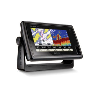
GPS-Combo, 7, Touch-screen, Map-721x
Chartplotter with a 7-inch Touchscreen Display 7-inch WVGA touchscreen display with pinch-to-zoom 10 Hz GPS/GLONASS receiver NMEA® 2000 and wireless connectivity Worldwide basemap GPSMAP 721 allows for easy visibility, day or night. Whether it is flat-, flush- or gimble-mounted, it…
 Shop
Shop