Global Positioning System
-
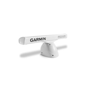
Radar, Open-Array Pedastal, 4kw, GMR-424 xHD2/426xHD2, w/o Antenna, 010-01333-00
4-foot Open Array Radar with 4 kW of Power 4 kW high-definition radar with 4-foot open array High sensitivity with 1.8 degree horizontal beamwidth for consistent target positions, excellent target separation and reliable operation Dual range radar with dual radar… -
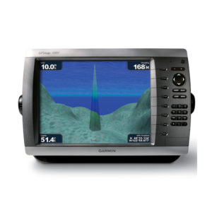
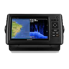
GPS-Combo, 10.4, 4010-Map
This mid-sized 4000 series chartplotter fills the gap between the smaller GPSMAP 4008 and the wider GPSMAP 4012. Like its counterparts, the 4010 serves as your all-in-one nerve center for the Garmin Marine Network. This chartplotter has crisp, video-quality resolution… -
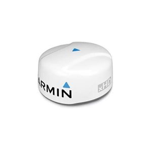
Radar, Dome, 18, 4kw, GMR-18-xHD, 010-00959-00
4 kW high-definition 18” dome radar Pairs ease of use with advanced open-array features 48 or 24 RPM rotation speeds for fast screen refreshes, auto adjusts as needed based on range 48 Mile max range setting No complex user settings,… -
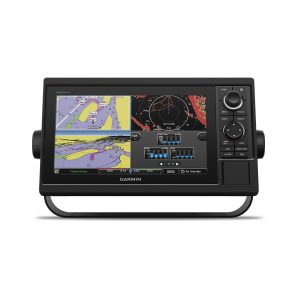
AQUAMAP 1052 ,Global Positioning System ,GPS
Infinite Fishing with New AQUAMAP Multi language support : English, Simplified Chinese, Traditional Chinese, Japanese, Korean, Thai, Indonesia Bahasa, Malaysia Bahasa, Vietnamese, Burmese, Hindi, Gujarat. 10-inch color display with keypad interface and multifunction control knob. Fully network capable for Garmin… -
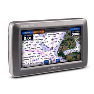
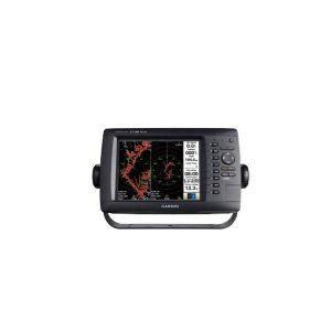
GPS-Combo, 10.4, 640-Map-C
This mid-sized 4000 series chartplotter fills the gap between the smaller GPSMAP 4008 and the wider GPSMAP 4012. Like its counterparts, the 4010 serves as your all-in-one nerve center for the Garmin Marine Network. This chartplotter has crisp, video-quality resolution… -
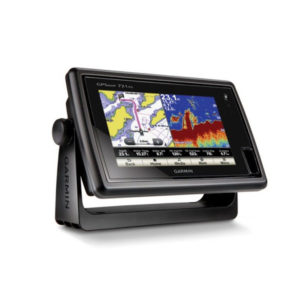
GPS-Combo, 7, Touch-screen, Map-721x
Chartplotter with a 7-inch Touchscreen Display 7-inch WVGA touchscreen display with pinch-to-zoom 10 Hz GPS/GLONASS receiver NMEA® 2000 and wireless connectivity Worldwide basemap GPSMAP 721 allows for easy visibility, day or night. Whether it is flat-, flush- or gimble-mounted, it… -
Aquamap 80xs ,Global Positioning System ,GPS
မြန်မာဘာသာဖြင့် အသုံးပြုနိုင်ခြင်း၊ (၈)လက်မ Colour မျက်နှာပြင်ဖြင့် အသုံးပြုနိုင်ခြင်း၊ ရေအောက်ကြည့် ှSonar, Way Point (12,000), Track (200), Route (200) Data Card 2 Card အပြင် Sounder နှင့် Rader ကို တွဲဘက် အသုံးပြုနိုင်ခြင်း၊ Sonar Record လုပ်နိုင်ခြင်း။ -
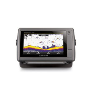
GPS-Combo, 7, Touch, Colour, echoMAP-70-s
An Amazing Combo with a 7" Touchscreen Display 7" WVGA touchscreen display with pinch-to-zoom HD-ID sonar 500W (77/200 kHz) transducer 10 Hz GPS/GLONASS receiver Wireless connectivity -
GPS-Combo, 7, Colour, echoMap-72-dv
(၇) လက်မ ကာလာမျက်နှာပြင်ဖြင့် အသုံးပြုနိုင်ခြင်း၊ ကြည်လင်ပြတ်သားသော ရေအောက်ကြည့် Sonar ပါ တစ်ပါတည်းတွဲဖက်ပါဝင်ခြင်း၊ အမှတ် (၅၀၀၀) လမ်းကြောင်း (၁၀၀) အထိ မှတ်သားနိုင်ခြင်း၊ စက်အတွင်း၌ ဂြိုလ်တုခေါင်း တစ်ပါတည်းပါဝင်ခြင်း၊ ရေအောက်အနက် ပေ (၂၀၀၀) အထိကြည့်ရှုနိုင်ခြင်း၊ လှိုင်းလွှင့်အား (၂)မျိုးရှိသော Sonar ခေါင်း တစ်ပါတည်း ပါဝင်ခြင်း။ -
GPS-MFD, 8, Colour, MAP-2108-Plus, Myanmar Font
မြန်မာစာတန်းထိုးဖြင့် အသုံးပြုနိုင်ခြင်း။ ၈ လက်မ ကာလာမျက်နှာပြင်ဖြင့် အသုံးပြုနိုင်ခြင်း။ Point (12000), Tracks (200), Routes (100) ထိ မှတ်သားနိုင်ခြင်း။ ရေဒါဖြင့် တွဲဖက်အသုံးပြုနိုင်ခြင်း။ -
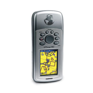
GPSMap 96C, 3″, Cplour, Aviation ,GPS
The portable GPSMAP 96, along with the color GPSMAP 96C, integrate full-featured GPS navigation with a Jeppesen database and comprehensive towers-and-obstacles database — giving pilots the freedom to go anywhere. The pilot-friendly GPSMAP 96 has a bright, sunlight-readable, 4-level grayscale… -
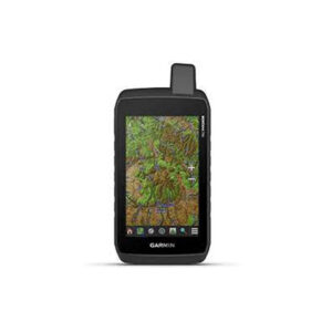
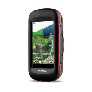
Montana 700 Handheld Hiking GPS
Montana 700 Lithium-ion battery pack USB cable Documentation Inquiry Now! -
Montana 680 , GPS
Touch Screen ဖြင့် အသုံးပြုနိုင်ခြင်း၊ 4'' လက်မ ကာလာမျက်နှာပြင်၊ 8 Megapixel Camera ပါဝင်ပြီး ဓာတ်ပုံများအား ကြည်လင်ပြတ်သားစွာ ရိုက်ကူးနိုင်ခြင်း၊ Micro SD Card ထည့်သွင်းနိုင်ခြင်း၊ Memory 4GB ပါဝင်ခြင်း၊ Way Point 10000, Tracks 250, Routes 250, အထိမှတ်သားနိုင်ခြင်း၊ Barometic Altimeter ဖြင့် အမြင့်ပေ တိုင်းတာနိုင်ခြင်း၊ Battery Type နှစ်မျိုးဖြင့် အသုံးပြုနိုင်ခြင်း။ Rugged GPS/GLONASS… -
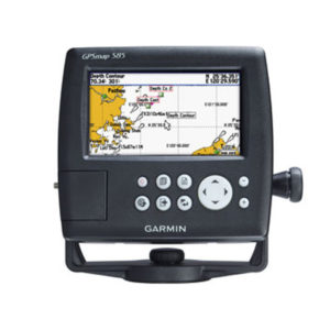
GPSMap 585 ,Ch Plotter, 5″, Colour, Marine GPS
The GPSMAP 585 is a full-function chart plotter that features an ultra-bright 5” WQVGA color display along with an improved feature of high-speed map drawing and panning. It’s ready to go with an easy-to-use interface and a built-in worldwide basemap.… -
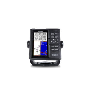
GPS-Fish-Finder, 6, FF-650-GPS APAC, Display only, AIS compatble
Multi language support : English, Simplified Chinese, Traditional Chinese, Japanese, Korean, Indonesia Bahasa, Malaysia Bahasa, Vietnamese, Burmese, Thai. Available in bigger and clearer 6-inch WVGA color, portrait mode display. Offers a keyed interface with dedicated buttons. CHIRP sonar sends a… -
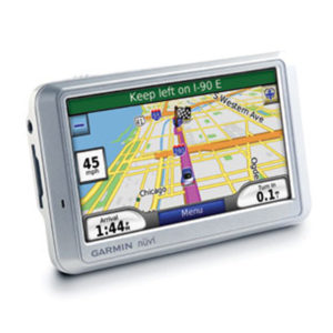
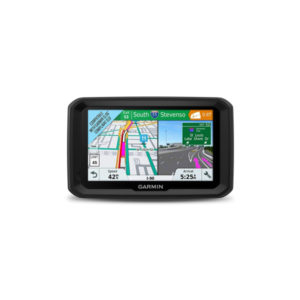
GPS-PND, Nuvi-710
Arrive stress-free with nüvi 710, a GPS navigator and personal travel assistant. Like the rest of the wide nüvi 700-series, its premium navigation capabilities, like route planning and an emergency locator, give you peace of mind on the go. -
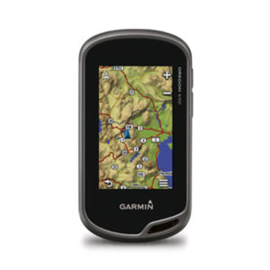
GPS-Outdoor HH, 3, Colour, Oregon 650-WW, camera, altimeter, compass
3-inch sunlight-readable touchscreen display with dual orientation 8 megapixel autofocus camera with LED flash/torch Worldwide basemap with shaded relief 3-axis compass with accelerometer and barometric altimeter sensors Dual battery system — 2 AA batteries or included rechargeable internal NiMH pack… -
GPS-Combo, 5 MAP-580 w/o Sonar
The GPSMAP 580 is a full-function chart plotter that features an ultra-bright 5” WQVGA color display along with an improved feature of high-speed map drawing and panning. It’s ready to go with an easy-to-use interface and a built-in worldwide basemap.… -
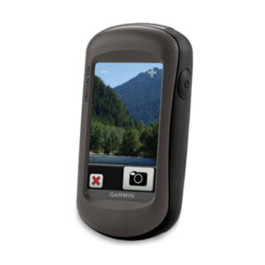
GPS-Outdoor, 3, Colour, Touch-screen, Oregon-550
Capture locations and memories with a 3.2 megapixel autofocus digital camera with 4x digital zoom Tough, 3-inch diagonal, sunlight-readable, color touchscreen display Built-in 3-axis tilt-compensated electronic compass shows your heading even when you're standing still, without holding it level Barometric… -
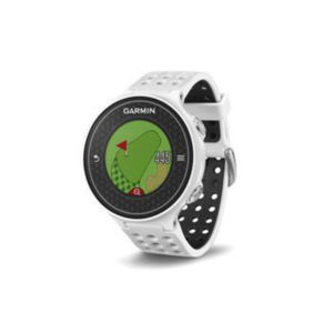
Approach S6 ,Golf Watch, Light (APAC), Myanmar Cources
Features swing metrics: SwingTempo, TempoTraining and SwingStrength Dedicated CourseView button with Green View for manual pin positioning PinPointer blind shot assistance tells you where the pin is, even if you can’t see it Touchscreen, high-resolution, glove-friendly Precise distances for more… -
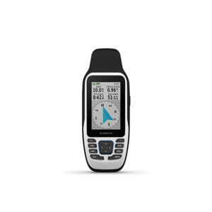
Garmin GPSMAP 79S
လိုင်းစွဲအား ကောင်းမွန်တဲ့ high-sensitivity GPS receiver တပ်ဆင်ထားခြင်း အရပ်မျက်နှာ၊ ဒီဂရီများ ကြည့်ရှုနိုင်တဲ့ 3-axis compassနှင့် လေထုဖိအား၊ အမြင့်ပေတိုင်းတဲ့ Barometric Altimeter တို့ ပါဝင်ခြင်း ၂.၆ လက်မ ကာလာမျက်နှာပြင် ဖြစ်ပြီး နေရောင်အောက်တွင်လည်း ကောင်းမွန်စွာ ကြည့်ရှုအသုံးပြုနိုင်ခြင်း ရေစိုခံနိုင်မှု water rating IPX 7 ဖြစ်တဲ့အတွက် အကြမ်းခံခြင်း world wide based map (ကမ္ဘာ့မြေပုံကြမ်း) Built In ပါဝင်ခြင်း ကြိုးမဲ့ချိတ်ဆက်မှု… -
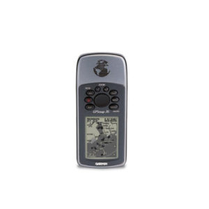
GPS-Outdoor HH, 2.6, 76-Map
The GPSMAP 76 adds an Americas, European or Pacific basemap and 8 megabytes (MB) of map storage space to the other outstanding features of the mariner-friendly 76-series navigators. The GPSMAP 76 floats in water, and it's IPX7 water resistant to… -
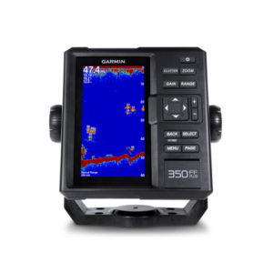
FF 350plus, Fishfinder, Colour, Marine GPS
Find fish, Catch fish, Affordable price Multi language support : English, Simplified Chinese, Traditional Chinese, Japanese, Korean, Indonesia Bahasa, Malaysia Bahasa, Vietnamese, Burmese, Thai. Available in bigger and clearer 6-inch WVGA color, portrait mode display. Offers a keyed interface with… -
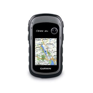
GPS-Outdoor HH, 2.2 colour, eTrex-30-x, altimeter, compass- for out door
Greater resolution with 240 x 320 display pixels for improved readability Internal memory expanded to hold more maps Worldwide basemap with shaded relief 2.2-inch, 65K color, sunlight-readable display 3-axis compass and barometric altimeter eTrex 30x is our upgraded version of…
 Shop
Shop